our partners




Get updates on mail
address
270 Angas St,
Adelaide SA 5000
Copyright © 2026 Bicycle SA. All Rights Reserved.
270 Angas St,
Adelaide SA 5000
Copyright © 2026 Bicycle SA. All Rights Reserved.
Route Summary
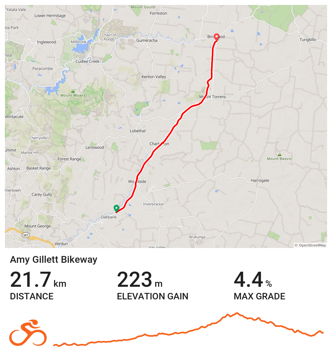
Distance: Approximately 22 km (one way)
Start Point: Oakbank (near Oakbank Racecourse)
End Point: Birdwood
Trail Type: Converted rail corridor (shared-use rail trail)
Surface: Predominantly sealed shared-use path
Terrain: Gentle, consistent gradients following the former railway alignment
Introduction
The Amy Gillett Pathway is one of the state’s most loved cycling trails in South Australia. Following the former railway corridor between the Adelaide Hills and the Murraylands, the gentle trail is a popular Adelaide Hills cycling trail, offering beautiful scenery through farmland, creek lines and small townships, all within easy reach of Adelaide.
Named in honour of the Australian cyclist Amy Gillett, the pathway reflects the spirit of inclusive, community-based riding and is widely regarded as a family friendly cycling trail. With a well-rounded sealed surface and frequent access points, this traffic free cycling path appeals to people of all ages and abilities, from families and first-time riders through to experienced cyclists seeking a relaxed day out.
History
The Amy Gillett Pathway traces the route of a former railway line that once connected Adelaide Hills towns to Adelaide and surrounding regions, making it one of the most established rail trails in South Australia. After the railway ceased operations, the corridor presented a unique opportunity to create a safe, continuous shared use cycling path for cyclists, walkers and the local community.
The pathway was named in honour of Amy Gillett, an Australian cyclist who tragically lost her life while representing the country in 2005. The name reflects both her legacy and a broader commitment to promoting safe and enjoyable cycling in South Australia. Since its creation, the pathway has grown in popularity, with community and council support helping to maintain and extend it. Over time, the trail has been improved with sealed surfaces, signage, trailheads and town connections, strengthening its reputation as one of South Australia’s most accessible cycling routes.
Significance
The Amy Gillett Pathway holds significance on multiple levels. For the local community, it provides a safe and scenic corridor for commuting, exercise and recreational cycling in the Adelaide Hills. For visiting riders, it offers a welcoming introduction to cycling trails near Adelaide, combining gentle gradients with the charm of rural towns and rolling farmland.
It is also a strong symbol of inclusive cycling in South Australia, encouraging riders of all ages and abilities to experience the Hills comfortably and confidently. By linking towns, open countryside and local attractions, the pathway supports regional cycling tourism while promoting active lifestyles. Beyond recreation, it stands as a lasting tribute to Amy Gillett’s memory and continues to inspire safe cycling culture across the state.
Explore the Trail Sections
Southern Section
Oakbank to Woodside
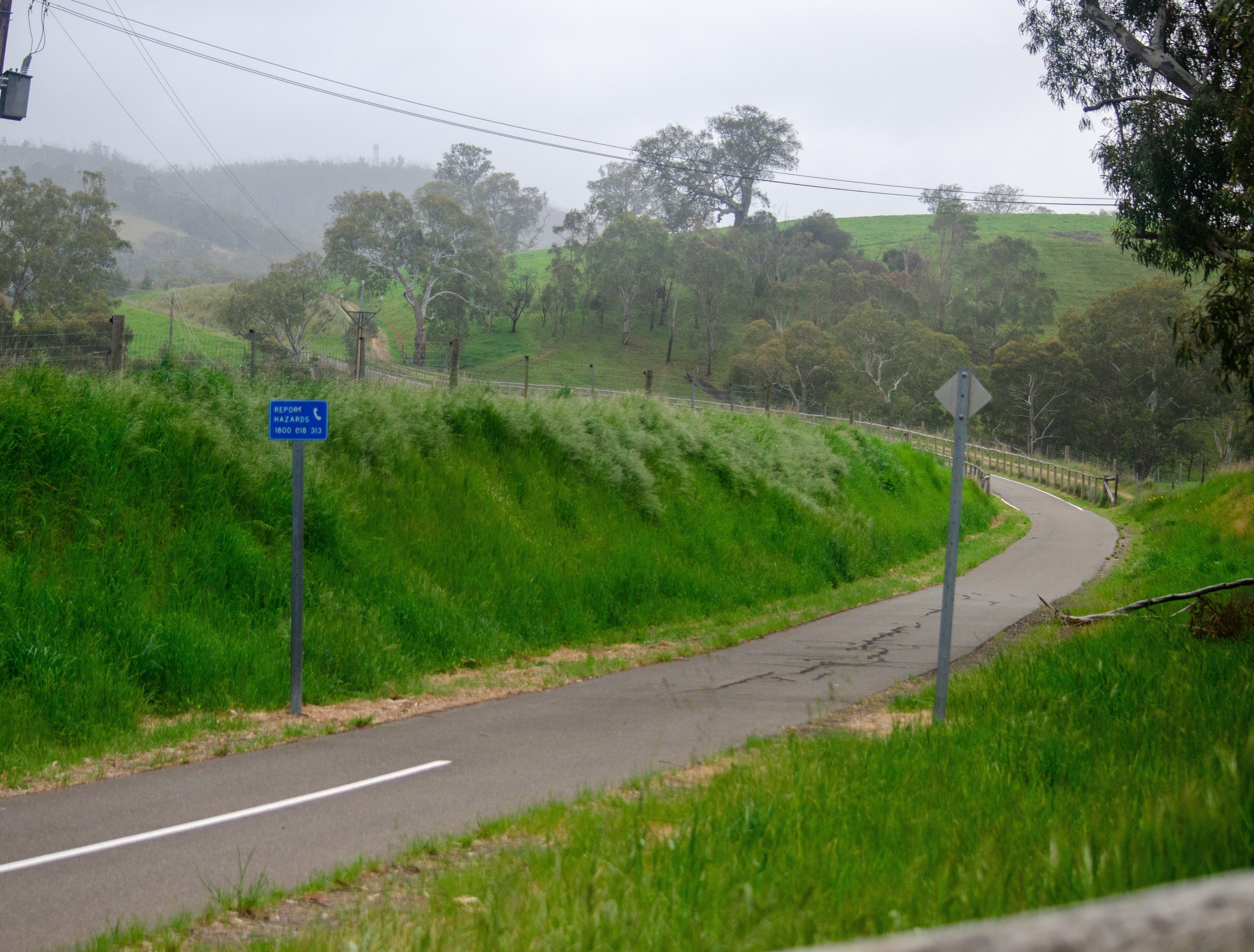
The pathway begins at Oakbank, a historic village well known to riders using this Adelaide Hills bike path. From here, the sealed surface follows the old rail alignment through fertile farmland and open valleys, offering classic scenery typical of cycling trails in the Adelaide Hills.
This southern portion of the path is smooth and user friendly, making it ideal for short rides from Adelaide or relaxed family cycling experiences. Woodside marks a natural stopping point, with the trail passing close to town and providing easy access to food, rest and services.
Central Section
Woodside to Mount Torrens
Between Woodside and Mount Torrens, the pathway continues its steady character as a classic rail trail cycling experience, maintaining gentle grades and uninterrupted riding. This section reinforces the relaxed nature of the route and suits longer social rides or casual touring.
The trail passes through quieter country, creating a sense of distance without difficulty. It works well for riders exploring regional cycling routes in South Australia and is equally suitable for out-and-back rides from either direction. Mount Torrens provides a natural midpoint and a clear sense of progression deeper into the Adelaide Hills.
Northern Section
Mount Torrens to Birdwood
North of Mount Torrens, the pathway extends through open agricultural land toward Birdwood, forming a scenic Birdwood cycling trail connection. Longer straights highlight wide rural views and reinforce the open feel of this northern section.
The sealed surface continues, keeping the riding consistent and approachable even after a full day on the bike. Birdwood marks the northern end of the pathway and offers a clear destination, reinforcing the point-to-point appeal of one of South Australia’s most recognised rail trails.
Local Ammenties
The Amy Gillett Pathway passes close to several Adelaide Hills towns, making it easy to combine cycling with cafes, pubs and cycling friendly accommodation. Riders can plan short rides with food stops, half-day outings or relaxed overnight trips while staying close to the Amy Gillett Pathway cycling corridor.