our partners


Get updates on mail
address
270 Angas St,
Adelaide SA 5000
Copyright © 2026 Bicycle SA. All Rights Reserved.
270 Angas St,
Adelaide SA 5000
Copyright © 2026 Bicycle SA. All Rights Reserved.
Route Summary
Distance: Approximately 16 km (one way)
Start Point: Adelaide Parklands
End Point: Marino Rocks
Trail Type: Shared-use urban and coastal bikeway
Surface: Sealed paths, bike lanes, and quiet streets
Terrain: Mostly flat with gentle gradients
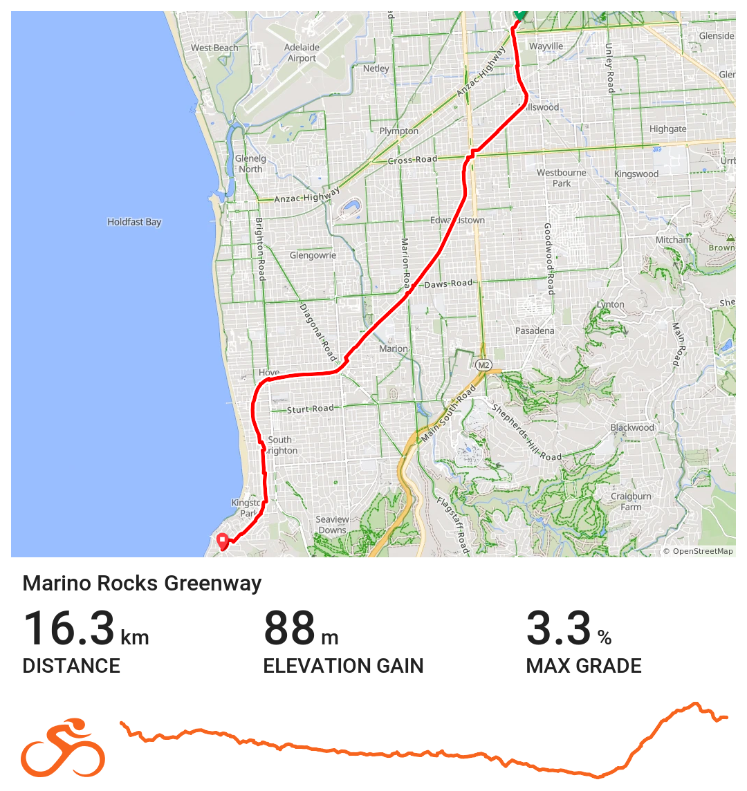
View access to the full route here
Introduction
The Marino Rocks Greenway is one of Adelaide’s premier urban cycling trails, connecting the Adelaide Parklands with the coastal suburb of Marino Rocks. Running alongside the Seaford railway corridor, this flat, sealed shared-use path is perfect for family-friendly cycling, commuter rides, recreational cycling, and beginner cyclists exploring the southern Adelaide suburbs.
This trail combines dedicated bike paths, quiet streets, and rail side corridors, providing a safe, accessible, and enjoyable cycling experience. Frequent access points, clear directional signage, and connections to local parks, reserves, and transport hubs make it easy for riders to plan short trips, full-day rides, or scenic leisure outings.
History
The Marino Rocks Greenway follows a historic corridor alongside the Adelaide to Seaford railway, a vital transport link connecting Adelaide with its southern suburbs for over a century. Originally built to support commuter rail traffic, the corridor has been repurposed to create a modern urban cycling route for South Australia, supporting active transport and recreational activity while preserving the corridor’s historical significance.
By converting this rail corridor into a shared-use trail, Adelaide has created a space that supports cycling, walking, and sustainable urban mobility, reflecting the city’s ongoing commitment to healthy lifestyles, safe commuting, and community connection.
Significance
The Marino Rocks Greenway is a key urban cycling route in Adelaide, demonstrating how rail side paths can enhance city cycling networks while offering recreational and commuter benefits.
The trail is ideal for commuting cyclists, leisure riders, and families, with flat, smooth surfaces and minimal gradients. It connects riders to parks, schools, reserves, and coastal attractions, while also linking to other major trails such as the Mike Turtur Bikeway.
The Greenway supports local tourism and community activity, encouraging exploration of surrounding suburbs, cafes, and local amenities, while providing an easy and safe introduction to urban and coastal cycling in Adelaide.
Explore the Trail in Two Sections
Adelaide Parklands to Sturt Creek Bikeway
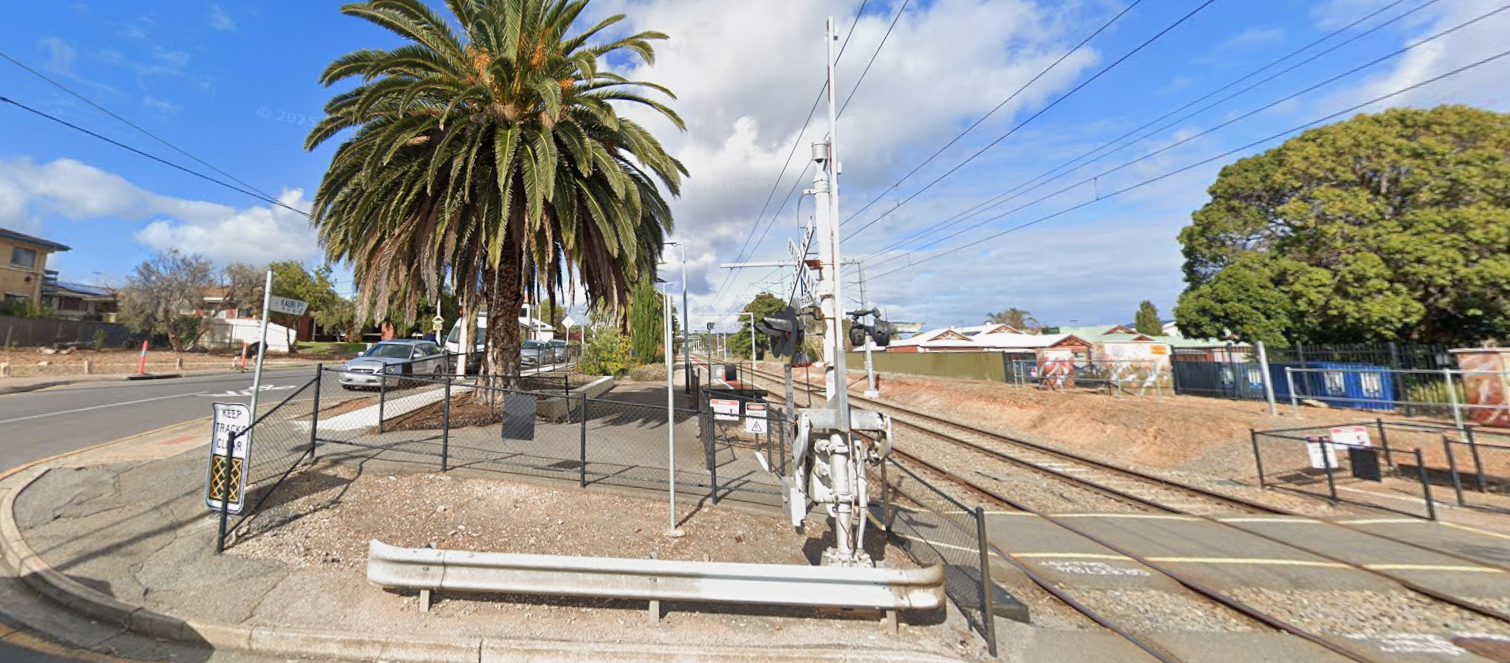
Starting near the Adelaide Parklands, this section follows the Seaford railway corridor through quiet streets and shared paths. Riders pass landmarks including Goodwood Station and the Adelaide Showgrounds, navigating underpasses and dedicated cycling lanes.
This northern section is ideal for beginners, families, and urban commuters, with smooth, flat surfaces and clear access to nearby trails for extended rides.
Sturt Creek Bikeway to Marino Rocks
Continuing south, the trail passes through Oaklands, Brighton, and Seacliff, using bike lanes, quiet streets, and shared paths before reaching the coastal destination of Marino Rocks. Riders are rewarded with ocean views, seaside reserves, and access to Marino Rocks Station.
This section is perfect for recreational cycling, family outings, and combined bike-train adventures, offering a mix of urban and coastal scenery.
Food and Accommodation
Along the Marino Rocks Greenway, riders can access cafés, bakeries, and takeaway food options in nearby suburbs, making it simple to plan refreshment stops during rides. Accommodation options are available in Marino, Brighton, and surrounding coastal suburbs, supporting overnight stays or multi-day cycling adventures. With proximity to the coast and parklands, the trail is ideal for combining cycling with beachside walks, picnics, or family recreation.